![[3731184] Map of the United States, Showing the Territory in Possession of the Federal Union, January, 1864. Bacon, Lithographers Co.](https://rareamericana.cdn.bibliopolis.com/pictures/3731184.jpg?width=768&height=1000&fit=bounds&auto=webp&v=1639167233)
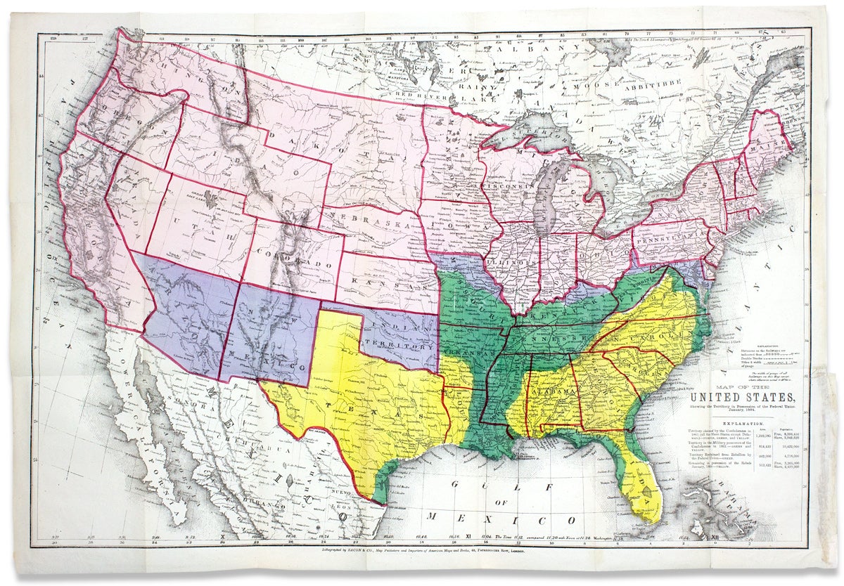
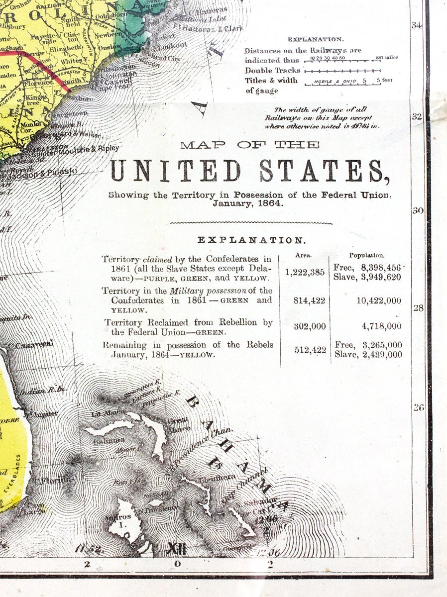
Map of the United States, Showing the Territory in Possession of the Federal Union, January, 1864.
“The special feature which gives outstanding interest to this cartographical production is the inclusion of all that was hereafter to be Wyoming…”
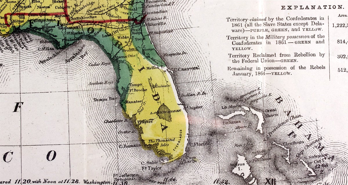
An unusual 1864 Civil War map distinguishing territory controlled by the Federal Union from that remaining in possession of the Confederacy. Together, areas tinted purple, green, and yellow show the claimed territory of the Confederate States at the beginning of the war (basically all the slave states except Delaware), most of it under Confederate military control.
A closer reading of the map’s color key, however, reveals a shrinking Confederacy. Green areas emphasize territory reclaimed by the Union, leaving the yellow portion to show the narrowing Rebel remains. Importantly, the reclaimed Union territory includes areas of high slave concentrations, now oases of Black emancipation. These comprise the Virginia Tidewater, the Sea Island coast of South Carolina and Georgia, and the Black Belts of Northeastern Mississippi and along the Mississippi River from Tennessee to New Orleans. A table below the title reporting free and slave populations shows that the number of slaves under Confederate control was reduced by ~38% as of January 1864.
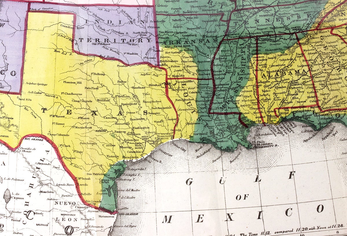
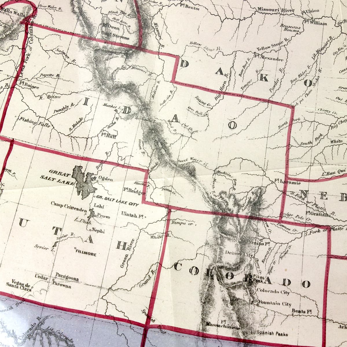
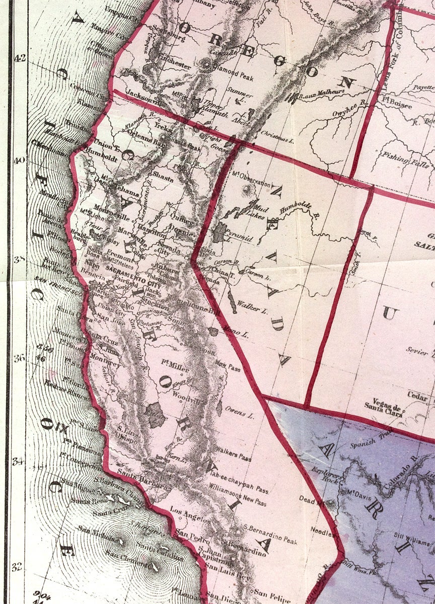
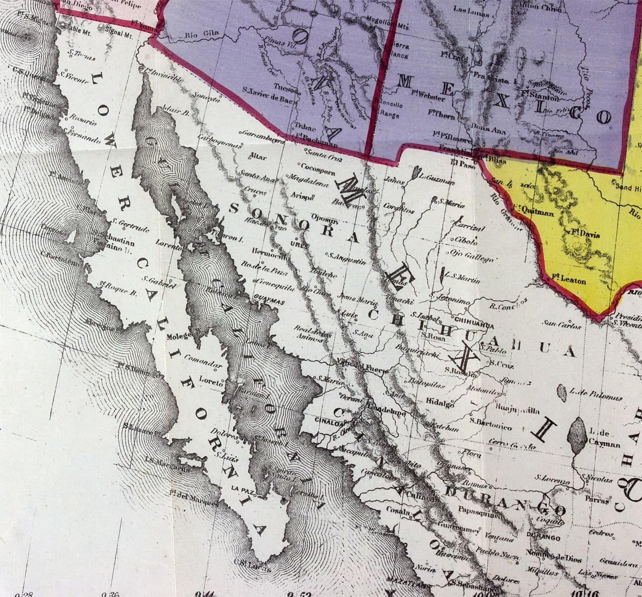
The depiction of the Rocky Mountain territories of the West is notable. Dakota Territory expands through present-day Montana to meet Washington State and “Idao” (so spelled, i.e. Idaho) lacks its upper panhandle and includes today’s Wyoming. Other features of the West include the outline of “Indian Territory” (now Oklahoma) and the location and names of multiple forts and military camps there and in central and western Texas (two “Camp Colorados”), New Mexico, and Arizona, all areas formerly claimed as Confederate territory.
Description: Map of the United States, Showing the Territory in Possession of the Federal Union, January, 1864.
London: Lithographed by Bacon & Co., Map Publishers and Importers of American Maps and Books, [1864]. 27½ x 19 inches. Vibrantly hand-colored. Two closed tear expertly mended on verso with tissue. Housed in archival Mylar sleeve. Very good.
[3731184]Eberstadt: “The special feature which gives outstanding interest to this cartographical production is the inclusion of all that was hereafter to be Wyoming within the boundaries of Idaho, and the naming of that Territory ‘IDAO.’” The map was issued with Massie’s America: The Origin of her Present Conflict; her Prospect for the Slave, and her Claim for Anti-Slavery Sympathy…. (See Sabin 46185. Coulter 318. Howes M-384. LCP, Afro-Americana 6545.) IB100
Price: $2,000.00