![[3725149] Nineteenth Century Copy of 1854 Land Indenture and Plat Map for Hudson River Front Property in Jersey City, New Jersey. Charles J. Smith Dudley S. Gregory, Andrew Clerk.](https://rareamericana.cdn.bibliopolis.com/pictures/3725149.jpg?width=768&height=1000&fit=bounds&auto=webp&v=1533057244)
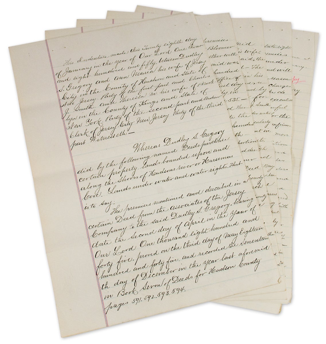
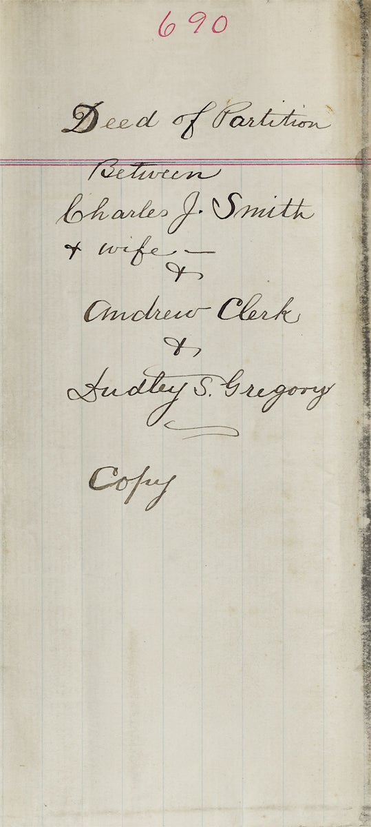
Nineteenth Century Copy of 1854 Land Indenture and Plat Map for Hudson River Front Property in Jersey City, New Jersey
Reclaiming submerged lands in Jersey City
In 1854, parts of Jersey City, New Jersey were under water. In the city’s Hudson River front district, called Harsimus Bay or Cove, three land owners wanted to reclaim some of these submerged lands.
In order to do so, however, the bounds of their properties needed to be properly set forth and clarified. They did so by means of a new indenture and the creation of a plat map “to illustrate the boundary and partition” of their respective tracts.
This indenture and accompanying plat map were originally prepared and surveyed in 1854. Watermarks in the paper upon which the present indenture is written suggest it was copied in the late nineteenth century. Thus, we date these two items to c. 1880s–1890s.
It is not clear who caused the copy to be made. The arduous work of reclaiming submerged lands may have led to ongoing difficulties and the need to clarify potentially conflicting claims between neighbors:
And whereas the said Dudley S. Gregory [party of the first part] under the authority contained in the said Deeds, has commenced to fill in and reclaim lands under water in the waters of Hudsons [sic] River or her Harsimus Cove, and put down and caused to be placed in and upon said lands under water certain cribs Bulkheads and Structures — And whereas the said Parties of the first second and third part hereto are desirous of filling in and reclaiming lands under water in front of or near to their respective lands bounded upon the water as aforesaid —
A map was needed too:
And whereas the Parties hereto are desirous of fixing settleing [sic] and establishing a boundary and partition of the lands under water and water rights between them…and to this end have caused a map showing such partition to be made — which is hereunto attached… (pp.7–8)
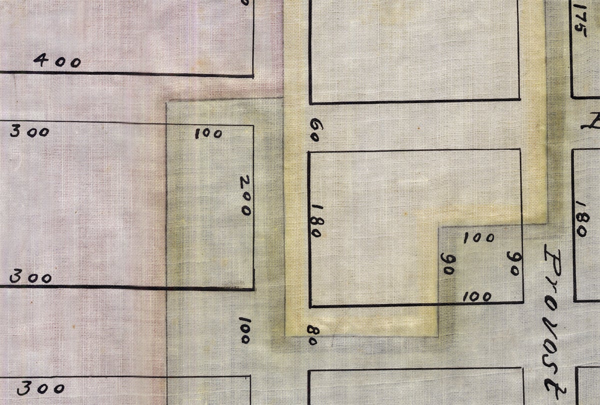
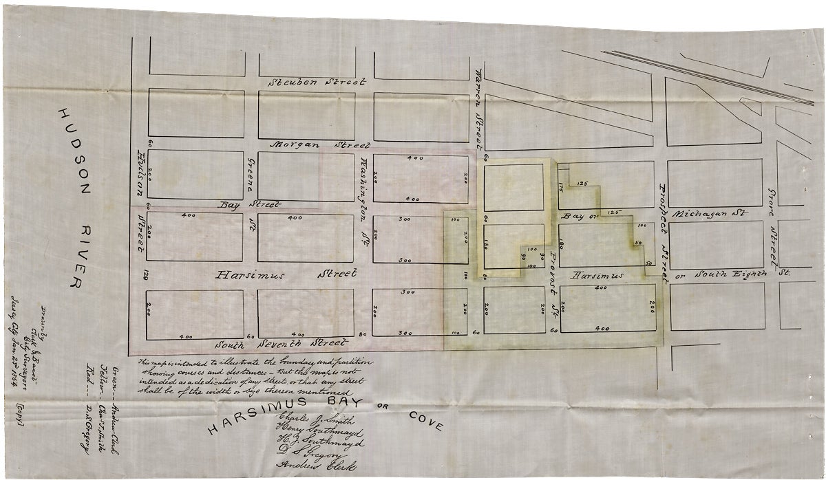
The indenture aggregates together the various deeds held by the three land owners (and their wives) to make each land owners’ property claims clear. This information is rendered graphically on a plat map copied here from the original 1854 survey drawn by Clerk & Bacst, City Surveyors of Jersey City.
Each tract is shown on the grid of the city’s streets or, what may have been, proposed streets. Each is outlined in red, yellow, or green watercolor and infilled with a wash of the respective color.
The area shown is bounded by Hudson Street on the east, Steuben Street on the south, Prospect Street on the west, and South Seventh Street on the north.
Description: Nineteenth Century Copy of 1854 Land Indenture and Plat Map for Hudson River Front Property in Jersey City, New Jersey
[Likely Jersey City, Hudson County, New Jersey, c. 1880s–1890s]. 17pp. Indenture. 12½ x 8 inches. Five loose bifoliums; watermarked “Platner & Porter Superfine”. [with] [1]p. Plat Map. Approx. 21 x 11½ inches. Cloth with ink manuscript and watercolor highlights. All near fine.
[3725149]Price: $225.00